
Cabo Roig: Natural Beaches, Coastal Path and Historic Fortress
Accommodation in Cabo Roig
Cabo Roig invites you to view the coast from several perspectives: beaches, nature, paths, history and the marina are among the themes that can be explored together here. Specific features of the area make these themes tangible without reducing the coastal town to a single type of holiday.
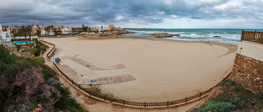 File:Beach in Cala Capitán in Cabo Roig in Orihuela Costa, Orihuela, Alicante, Spain, 2022 January - 2.jpg
Photo: Ximonic (Simo Räsänen) via Source, CC BY-SA 4.0
File:Beach in Cala Capitán in Cabo Roig in Orihuela Costa, Orihuela, Alicante, Spain, 2022 January - 2.jpg
Photo: Ximonic (Simo Räsänen) via Source, CC BY-SA 4.0
When choosing a holiday apartment in Cabo Roig, you can compare travel dates, room categories and cancellation policies on accommodation listing pages. These three fields provide a practical complement to the various features of the area and can be considered separately from the information about the beaches, path and marina.
Coast and Beaches
Cala Capitán is a natural beach with golden sand. It is 312 metres long and covers an area of 15,203.65 square metres. The beach can be reached via the CN-332 Alicante–Cartagena road.
La Caleta, also known as Playa de Cabo Roig, is a natural beach at the southern end of Cabo Roig. It is 387 metres long and covers an area of more than 16,000 square metres. Cabo Roig protects La Caleta with its rock walls and ensures very calm water there. La Caleta is accessible to people with disabilities and offers public toilets, foot showers, a beach bar, an area for sports activities, parasols and sun loungers. During the summer season, lifeguard and bathing-supervision services are available there. There is also a shaded area and a car park for people with functional disabilities. The different lengths and areas of the two beaches can be compared as separate measurements.
Nature and Paths
The Sendero Azul Cabo Roig is 2.46 kilometres long, takes around one hour and is rated easy in difficulty. It runs parallel to the coast between Cala Capitán and La Caleta and includes five viewpoints. The path passes cliffs and beaches with rock materials of significant geological interest.
In the inland section of the Sendero Azul Cabo Roig, the protected shrub Jarilla Cabeza de Gato (Helianthemum caput-felis) is found in large numbers. From the Sendero Azul Cabo Roig, the meadows of Posidonia oceanica can be seen in the water; they form underwater forests that serve as a refuge and food source for aquatic animals. Length, approximate duration and difficulty describe the path on different levels; the five viewpoints and the natural-history details complement this orientation.
Places at Cabo Roig
The Torre de Cabo Roig is a 16th-century military watchtower fortress and is classified as a Bien de Interés Cultural.
The Marina Cabo Roig is a small harbour facility protected by Cabo Roig, with a small social club. Marina services include parking, taxis, a ramp, a crane, toilets and showers.
Other places for regional orientation: Playa Flamenca, La Zenia, Torremendo, Punta Prima, Hurchillo, Los Balcones, Dehesa De Campoamor, Castillo De Don Juan
For the broader travel overview: Orihuela.

