
Benimantell – Hiking Trails, Cultural Heritage and Olleta de Blat
Accommodation in Benimantell
The partially circular, well-signposted hiking trail “Sender de la Serra” starts and ends in Benimantell. It is approximately 12 kilometres long, and the walking time is around three hours.
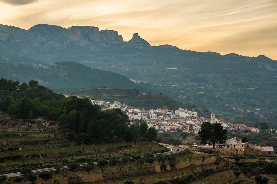 File:Benimantell village as seen from Castell de Guadalest in Alicante, Valencia, Spain, 2020 January.jpg
Photo: Ximonic (Simo Räsänen) via Source, CC BY-SA 4.0
File:Benimantell village as seen from Castell de Guadalest in Alicante, Valencia, Spain, 2020 January.jpg
Photo: Ximonic (Simo Räsänen) via Source, CC BY-SA 4.0
The approximate length and walking time provide a guide to the time required for this hike.
Culture and Townscape
The parish church of Benimantell is dedicated to Saint Vincent Mártir and is an architecturally remarkable building. Its square bell tower consists of three sections and is topped by a hexagonal spire.
Extensive remains have been preserved at Castellet de Benimantell, including walls, the main tower, several smaller defensive towers and the remains of an Islamic cistern that supplied the fortress with water. The “Pi Ver” is a monumental pine tree considered an important natural and cultural heritage site in Benimantell. For the local population, it is a symbol and is regarded as a witness to the town’s history.
Near the Font del Molí, visitors can see a so-called “Clot de la neu”. The streets of Benimantell feature ceramic panels depicting religious scenes. The streets are steep and labyrinthine; shady alleyways evoke the layout of a medieval street network.
Nature and Hiking
The Guadalest Reservoir also covers parts of Benimantell’s municipal area. The PR-CV 9 hiking trail runs along part of Aitana’s southern slope, parallel to the Arc gorge, climbs to the Comptador Pass and then descends from there to Benimantell.
The PR-CV 9 is 16.30 kilometres long; the estimated walking time is 4 hours and 40 minutes. It ends at the junction with the CV-70 road in Benimantell. The different trail lengths and walking times provide a concrete basis for comparing hiking days by duration.
Climbing and Cycling
Benimantell has several climbing areas with sections for beginners and long routes. The options are suitable for all ability levels and age groups.
The “Vuelta a los pueblos del Valle” mountain bike route is a circular trail. It starts in Benimantell and follows alternative roads to the main road through all the other villages in the Guadalest Valley. Another mountain bike route from Benimantell to Altea connects the mountains with the sea, passes the reservoir and follows the course of the Guadalest River.
The route to Altea is classified as moderately difficult and is 22 kilometres long; this figure applies to the one-way route. The circular route, one-way route, length and difficulty level describe different ways of exploring the surrounding area by bicycle.
Culinary Delights
The nine-day Semana Gastronómica de la “Olleta de Blat” focuses on the traditional dish Olleta de Blat. The restaurants in Benimantell offer menus featuring traditional recipes and other specialities; the dish is regarded as a traditional staple of the villages in the Guadalest Valley.
On Saturday, the first day of the gastronomic week, the “Festa de l'Olleta de Blat” is held in Benimantell’s Plaza Mayor. During the event, the town’s restaurants offer a tasting of Olleta de Blat.
Getting There
Benimantell can be reached via the CV-70, which is connected to the AP-7.
Other places: Callosa D'en Sarrià, La Carroja, Benejúzar, Muntanya de la Sella, Monforte Del Cid, El Chaparral, San Miguel De Salinas, La Xara
To the higher-level travel overview: Alicante.

