
Sant Pere Molanta: Cultural Route, Church and Trails
Accommodation in Sant Pere Molanta
Sant Pere Molanta is the setting for the activity “Rutes pel Patrimoni – Visita a Sant Pere Molanta”. This guided cultural route leads through Sant Pere Molanta and its surroundings. The places visited include the Masia Fontallada de Can Torres. This masia is dated to 1742.
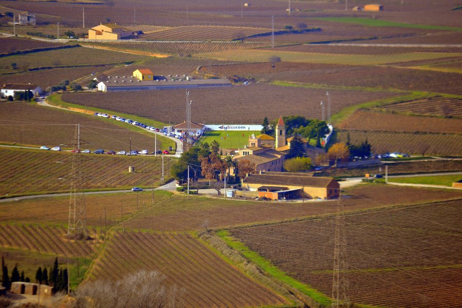 File:Església parroquial de Sant Pere Molanta (Olèrdola) - 1.jpg
Photo: Angela Llop via Wikimedia Commons, CC BY-SA 2.0
The route thus connects the village centre with a historic building outside the church. The name Can Torres appears both in Masia Fontallada de Can Torres and in the hamlet of Can Torres de la Font Tallada. The two names refer to different stops and local references around Sant Pere Molanta.
Culture
The church of Sant Pere Molanta has three naves and a rectangular chancel. Its façade is in the vernacular Baroque style. The top of the façade is curved. A square bell tower rises above one of the side naves. The church was completely rebuilt in 1744.
The building’s form can be identified through several clear features: its division into three naves, the rectangular chancel and the square tower above one of the side naves. In addition, the curved line at the top of the façade defines the vernacular Baroque style of the exterior. The complete rebuilding in 1744 is part of the documented building history of the church.
Next to the southern façade of the church lies the Sant Pere Molanta necropolis. It is located in the Cal Sadurní district. One of the milestones of the Sender de la Via Augusta stands in Sant Pere Molanta’s church square. The Roman milestone sarcophagus is 2.26 metres high. Two original letters of the inscription have survived at the top of the milestone.
A Roman milestone from the second half of the 1st century was reused as a sarcophagus in the Middle Ages. The connection between milestone and sarcophagus is therefore part of the traditional building and local history of Sant Pere Molanta.
Different historical testimonies therefore stand side by side in the same local area: the necropolis next to the southern façade, the milestone in the church square and the Roman stone later reused as a sarcophagus. Its height of 2.26 metres and the two surviving original letters make the stone described here additionally identifiable through specific details.
Trails and Surroundings
In the surrounding area, a path leads from the church of Sant Pere Molanta to the hamlet of Can Torres de la Font Tallada. From there, a somewhat poorer-quality track leads to the remote farmhouse of La Barquera. A walking path without any major difficulties also leads from there to Castellot de la Barquera.
The route is therefore structured around named points: the starting point is the church, followed by the hamlet of Can Torres de la Font Tallada, then the farmhouse of La Barquera and finally Castellot de la Barquera. The two connections from Can Torres are described as different types of path, namely a somewhat poorer-quality track and a walking path without any major difficulties.
Those who take this path to Castellot will find the walking path explicitly described as presenting no major difficulties. From Castellot de la Barquera, part of the Penedès plain was visible in the surrounding area of Sant Pere Molanta.
The view from Castellot refers to part of the Penedès plain, a landscape that was visible from the stated point in the surrounding area of Sant Pere Molanta.
Other Destinations
Another destination to discover is Moja.
Geographical Location
The church of Sant Pere Molanta is located on the BV-2415 at kilometre 1. From Vilafranca del Penedès, Sant Pere Molanta can be reached via the N-340 towards Barcelona. After approximately three kilometres, turn right onto the road to Olivella.
The directions therefore describe a specific road connection and sequence of directions: first take the N-340 towards Barcelona, then turn onto the road to Olivella. The distance of approximately three kilometres is explicitly an estimate. The reference to the BV-2415 is additionally recorded at kilometre point 1.
For the higher-level travel overview: Olèrdola.

