
Chasseradès: Holiday Apartments and Holiday Homes
Accommodation in Chasseradès
The difficult Moure de la Gardille circular hiking trail takes six hours, is 18.6 kilometres long, and begins and ends in Chasseradès. As a long-distance high-altitude hike, it leads north of Montagne du Goulet through pastureland and the Mercoire state forest, offering panoramas of Mont Lozère.
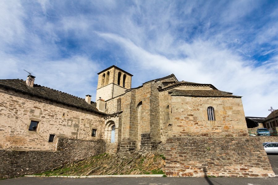 File:Église Saint-Blaise, Chasseradès, France.jpg
Photo: Édouard Hue ( User:EdouardHue ) via Wikimedia Commons, CC BY-SA 4.0
File:Église Saint-Blaise, Chasseradès, France.jpg
Photo: Édouard Hue ( User:EdouardHue ) via Wikimedia Commons, CC BY-SA 4.0
Le Panier Gourmand in Chasseradès offers food that is as local and fresh as possible, baked goods and snacks, as well as picnic baskets.
Nature
The Crête du Goulet is a difficult hiking trail in Chasseradès. The six-hour circular route includes 613 metres of ascent and 614 metres of descent and runs above the source areas of the Chassezac.
The GR 70, the Chemin de Stevenson, runs through the centre of Chasseradès.
Culture
The Church of Saint Blaise in Chasseradès is a well-preserved Romanesque building from the 12th century and is classified as a historic monument. It can be visited independently and without a guide at any time; the average visit lasts 30 minutes.
Geographical location
The delegated municipality of Mont Lozère et Goulet overlooks the Chassezac Valley. The Allier rises within its municipal territory.
Those travelling to Chasseradès may wish to rent a holiday apartment.
To the overview of the wider destination: Lozère.
Other destinations
Other places within the same destination:

