
Krupina District: Holiday Apartments and Holiday Homes
Accommodation in Krupina District
Geographical Location
Krupina lies on the floodplain of the Krupinica River at the boundary between the Štiavnické vrchy and the Krupinská planina.
Renting a holiday apartment in Krupina District is part of planning an individual stay.
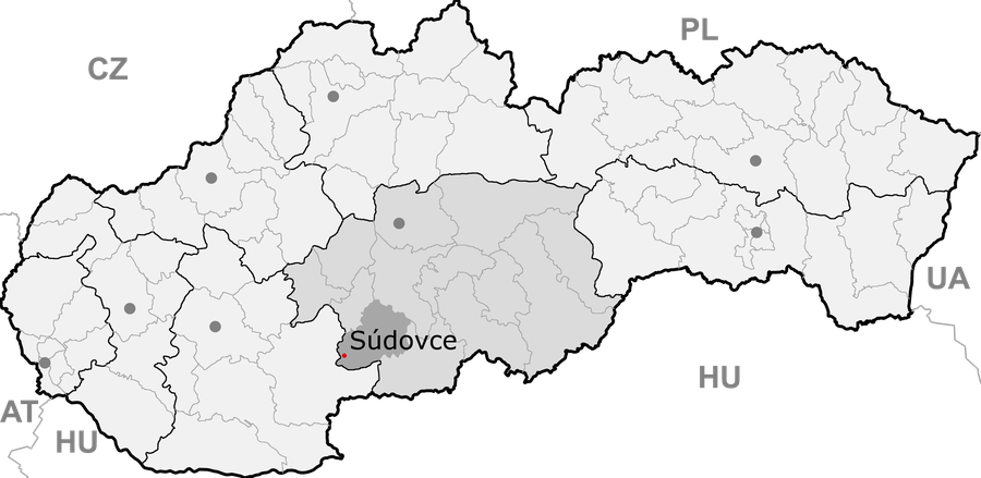 File:Okres Krupina - Sudovce (mapa).png
Photo: Slovakia_banskabystrica_krupina.png : Martin Proehl derivative work: Sudo77 ( talk ) via Source, Public domain
File:Okres Krupina - Sudovce (mapa).png
Photo: Slovakia_banskabystrica_krupina.png : Martin Proehl derivative work: Sudo77 ( talk ) via Source, Public domain
Culture and History
The Andrej Sládkovič Museum in Krupina has a permanent exhibition on the history of the town and literary figures, with a focus on Andrej Sládkovič and Elena Maróthy-Šoltésová. The “In the Footsteps of Andrej Sládkovič” walking trail in Krupina leads to 16 interesting places closely associated with the life of the Slovak poet.
The Sebechleby Ethnographic Museum is part of the Stará Hora Folk Architecture Reserve and displays regional costumes, folk traditions, and customs. In 1981, Stará Hora was included in the Slovak list of protected folk architecture reserves.
The cellar areas of the Andrej Sládkovič Museum, known as the Krupina Underground, can be visited during selected events and, following appropriate renovations, as part of a guided tour of the museum exhibition.
In addition to its exhibitions, the Lišov Museum offers encounters with local craftspeople and educational programs.
Čabraď Castle has been documented in writing since 1276 and historically served to protect the routes to the mining towns. Bzovík Fortress has a fortified complex with four projecting round corner bastions and a moat.
The Vartovka watchtower was built around 1564 during the conflicts with the Ottomans and is considered the only Slovak watchtower preserved in its original condition. The Church of the Nativity of the Virgin Mary in Krupina is a three-nave Romanesque basilica built by German colonists at the beginning of the 13th century.
Stará Huta is listed as a ruin in the vicinity of Krupina District. Šášov is listed as a ruin in the wider regional surroundings of Krupina District.
Exploration
Dudince lies in the southern part of Krupina District, in the valley of the Štiavnica River in the Hont region, and is known for its rare healing mineral water.
Nature and Landscape
The Štangarígeľ rock formation was declared a natural monument in 1975, covers 0.65 hectares, and lies in the Štiavnické vrchy Protected Landscape Area. Štangarígeľ, also known as Krupinské bralce, consists of regular five-sided andesite columns, some of which are up to 6 meters high.
The paved access road from Krupina to Štangarígeľ is often closed to cars about 4 km before the destination; tourist information recommends traveling by bicycle.
Vrch Pole is listed as a mountain in the immediate vicinity of Krupina District. Benčatov is listed as a mountain in the immediate vicinity of Krupina District. Zalaz is listed as a mountain in the vicinity of Krupina District. Horvátov Vrch is listed as a mountain in the vicinity of Krupina District.
The Mäsiarsky Bok National Nature Reserve covers more than 120 hectares and lies alongside the railway line and road between Krupina and Babiná. It combines fallen rocks with the flowing Krupinica River.
Čabradský hradný vrch and its surroundings are designated as a national nature reserve with the 5th-highest level of protection and constitute an important site for reptiles.
More local pages: Hontianske Nemce, Dudince, Selce, Karpfen, Čabradský Vrbovok, Devičie, Dolný Badín, Domaníky, Hontianske Moravce, Hontianske Tesáre, Horný Badín, Kozí Vrbovok, Lackov, Litava, Medovarce, Rykynčice, Sudince, Súdovce, Terany, Trpín, Uňatín, Žibritov, Jalšovík, Bzovík, Cerovo, Čekovce, Dolné Mladonice, Drážovce, Drienovo, Horné Mladonice, Kráľovce-Krnišov, Ladzany, Lišov, Sebechleby, Senohrad, Zemiansky Vrbovok.
To the higher-level travel overview: Banská Bystrica.

.png)