
Dobrzany: Town History and Trails
Accommodation in Dobrzany
Dobrzany combines a medieval town layout with traces of reconstruction after a fire in 1781. It is also where two trails cross in a region shaped by the Ice Age. This makes the town interesting for travellers who want to explore town history and landscape as distinct areas of interest. When planning your visit, you can consider whether you would rather spend your time on historic buildings and fortifications, or on longer trails and their surroundings.
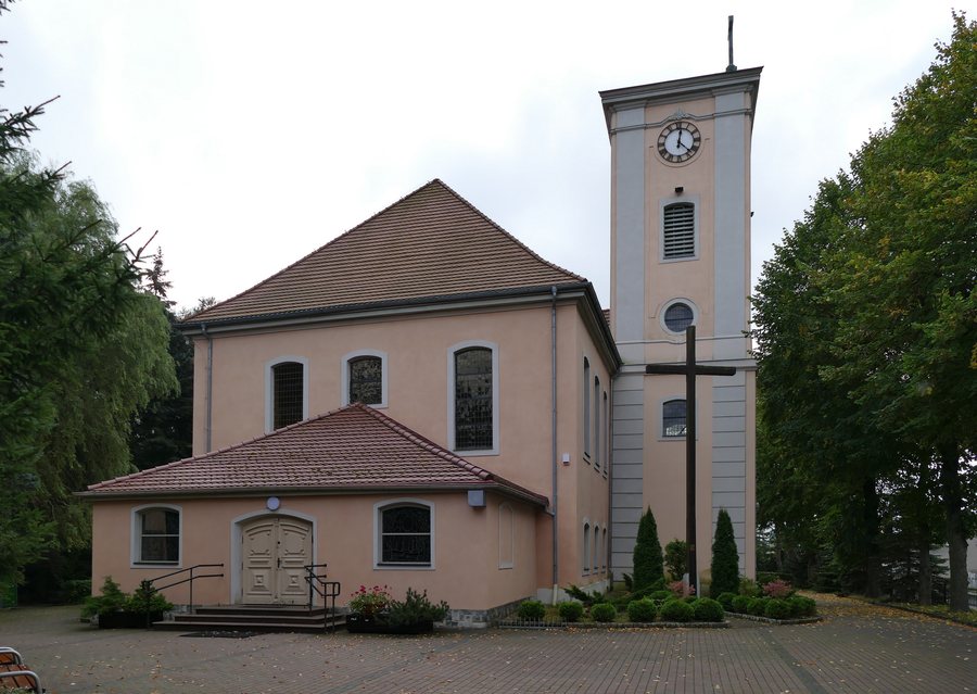
Gilly’s Urban Planning and St Michael’s Church
The Church of St Michael the Archangel dates from 1782–1784 and was designed by David Gilly. It is the only surviving building in Dobrzany designed by Gilly. The town’s history is also connected with his name: after the fire of 1781, Dobrzany was rebuilt in the 18th century according to a plan by Gilly. The medieval town layout and this later reconstruction together shape the town’s historical character.
The plan called for a regular arrangement of residential plots. Each plot was intended to accommodate two buildings with their gables facing the street. This means Dobrzany’s history can be explored not only through a single building, but also through the development of its urban fabric. The churchyard at St Michael’s dates from before 1781; the church and churchyard are jointly listed in the register of historic monuments under number A-1210.
Two Early Medieval Fortifications
The fortifications also point to different historical periods. East of the town is a ring-shaped hillfort with a double earth rampart, dating to the 9th–10th centuries. To the west is an early medieval fortification dating from the 11th–12th centuries. Those interested in the town’s early history can visit these two sites as separate stops: they differ both in their location within Dobrzany and in the periods to which they are attributed.
The Green and Red Trails through Dobrzany
The green Wzniesienia Moreny Czołowej trail and the red Stargard–Recz trail cross in Dobrzany. The green trail is 51 km long and passes through Dobrzany. Along the route, you can take in landforms shaped by the glacial moraine landscape. The red Hetman Stefan Czarniecki Trail passes through Dobrzany as part of its 62.5 km route from Stargard to Recz. The lengths of both trails give you a practical reference when planning to include longer routes in your trip.
The red trail’s name commemorates the stationing of Polish troops under the command of Hetman Stefan Czarniecki in the region in 1657. The route thus combines a trail with a historical connection, while the green trail focuses on the moraine landscape. When planning a trip together, you can weigh up whether you are more interested in landforms or in the historical background of a route.
The combination of town history, early medieval sites and two intersecting trails gives Dobrzany a distinct character. If you are looking for a holiday apartment in Dobrzany, you can consider whether this blend of historical interest and trails suits your itinerary. Families can decide together what to focus on: for example, the history of the town and its fortifications, or the landscape along the green trail.
More Places
Find more places at Rekowo, Granica, Morzyczyn, Chociwel, Brudzewice, Koszewko, Oświno and Pęzino.
For the broader travel overview: Stargard.

