
Kraśnik – Landscape, Routes and History
Accommodation in Kraśnik
Kraśnik offers a variety of ways to plan a trip: the Regional Museum focuses on the history of the town and the 24th Uhlan Regiment, while the landscape outside is shaped by the lowland, upland and river valley. There are also cycling and walking routes, historic sites and a beach area at Zalew Kraśnicki. When choosing where to stay, you can consider whether you want to focus mainly on discovering culture, spending time outdoors or balancing the two in different ways.
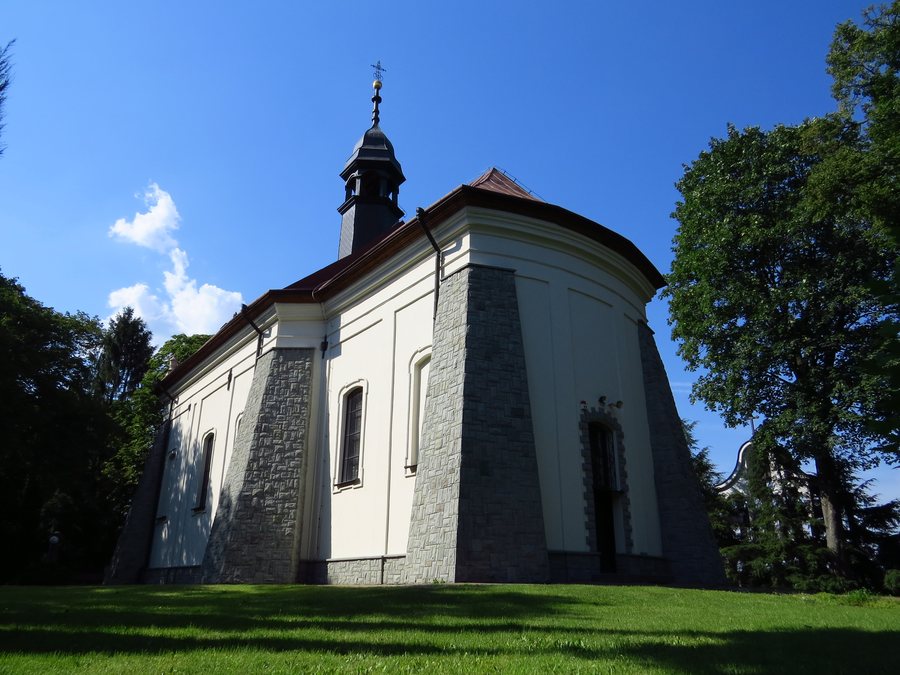 Kraśnik Hospital Church of the Holy Spirit
Photo: Maciej Piątek via Wikimedia Commons, CC BY-SA 3.0 pl
Kraśnik Hospital Church of the Holy Spirit
Photo: Maciej Piątek via Wikimedia Commons, CC BY-SA 3.0 pl
Landscape between lowland and upland
The Wyżnica lowland is Kraśnik’s dominant landscape feature. At the same time, there are marked differences in relative elevation between the upland and the river valley. This gives the landscape more than one consistent character: the lowland, higher ground and valley offer different vantage points from which to take in the surroundings. The western part of Roztocze also begins in Kraśnik. If you are looking for a holiday apartment in Kraśnik, you can consider the landscape one of the reasons to combine your stay with routes and outdoor exploration.
History in collections and buildings
The Regional Museum has permanent exhibitions on the 24th Uhlan Regiment and its history and traditions, the Battles of Kraśnik in 1914–1915, and historic Kraśnik. Its collections include regional history, historical, ethnographic and archaeological holdings. The museum thus offers different ways to explore the past, from the history of the town and region to the subjects of the regiment and the battles. If you are particularly interested in one of these areas, you can make it a focus when planning the cultural part of your trip.
Different memorial sites offer further insights. The Lubelska Izba Tradycji Pożarniczych has more than 720 exhibits, including equipment from before the First World War. The Izba Pamięci at the Centre for Culture and Promotion displays objects from the region’s past. The three-aisled Church of the Assumption of Mary dates from the 15th century. The synagogue has also been preserved and restored, and the town counts it among its most valuable historic monuments. The New Jewish Cemetery was established in the mid-19th century and is one of the stops on the Hasidic Route. Together, these places offer different points of interest for visitors drawn to regional history, religious heritage or historical collections.
Cycling and walking as distinct parts of a trip
Kraśnik railway station is named as a starting point for a cycling trip. An approximately 25 km cycling loop runs from Kraśnik via Dąbrowa-Bór, Popkowice, Kolonia Ostrów and Pułankowice, returning to Kraśnik. The approximate distance and the sequence of named places give you a concrete reference if you would like to include a circular ride in your trip. An approximately 20 km walking route starts and ends in Kraśnik’s Factory District. The two options offer different experiences: a cycling loop passing through several named places and a walking route that starts and finishes in the Factory District.
The Lubelskie Way of St James also passes through Kraśnik. The section in the Lubelskie Voivodeship is 135 km long. This places Kraśnik in the context of this longer route, too. The three details about cycling and walking routes describe different possibilities, each of which you can consider as a distinct part of your trip.
Beach area at Zalew Kraśnicki
Another option for planning your stay is the bathing beach at Zalew Kraśnicki. It has a beach area for leisure and sport. It is also possible to moor watercraft and other water sports equipment at the bathing beach. This complements the cultural and landscape-related attractions with a place where leisure and sporting activities are in focus. If you are looking for a holiday apartment in Kraśnik, you can choose your focus based on whether you would like to include museums and historic sites, routes through the landscape or the beach area in your trip.
About the destination Krasnik: Krasnik.
Other destinations at the same level: Opolski County, Parczew, Włodawa, Krasnystaw, Janowski, Ryki, Łęczna.
Back to the higher-level travel overview: Lublin.

.JPG)