
Holiday apartment in Ooltgensplaat – Fort, nature and hiking route
Accommodation in Ooltgensplaat
Ooltgensplaat can be explored through very different settings: Fort Prins Frederik, with its gun tower, recalls the French period; the town hall represents Renaissance architecture; and by the water there are birdwatching huts and a harbour canal. In the summer months, a ferry ride is also available. In addition, there is a hiking route starting at the town hall and the Kunstkruimelroute, which is connected to the 1953 flood disaster. The range extends from individual buildings to a 13.9-kilometre route and a seasonal ferry ride.
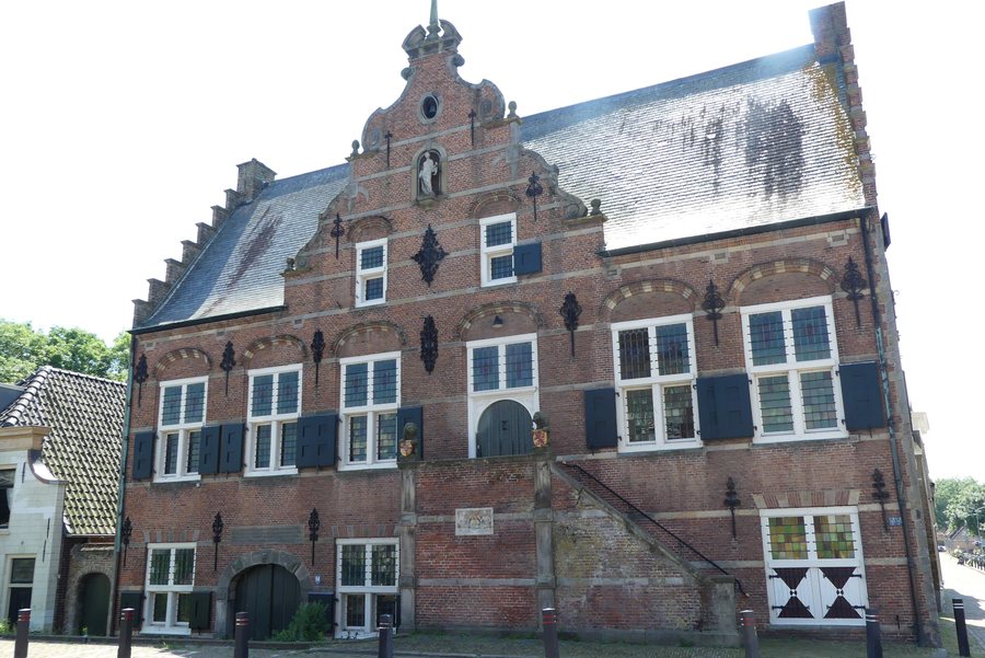
Fort, town hall and church
The gun tower of Fort Prins Frederik is the largest of the three surviving towers from the French period in the Netherlands. Fort Prins Frederik comprises a square, brick-built gun tower with a platform for cannons and embrasures. It was built shortly after 1811. Visits are possible during opening hours or by booking a guided tour. Those who want to explore history beyond Fort Prins Frederik will find two other specific buildings in Ooltgensplaat: the town hall and the Nederlands Hervormde Kerk at Voorstraat 52. For a visit to the fort, choosing between visiting during opening hours and taking a guided tour is part of the specific planning for the day.
Ooltgensplaat town hall is a building in the Dutch Renaissance style and was constructed in 1617–1618. When Ooltgensplaat town hall is open, visitors can attend talks and view exhibitions. The Nederlands Hervormde Kerk also stands at Voorstraat 52: it is a simple hall church dating from 1847, with a plastered tower and a Neoclassical portal with pilasters. With its hall layout, tower and portal, the church adds another specific architectural view to the historical exploration.
Hiking with a fixed starting point
The Tussen Fort en Kreek hiking route starts at Ooltgensplaat town hall. It is 13.9 kilometres long and can be shortened if necessary. For planning the day, you can choose between the full length and a shorter route. Starting at the town hall gives the trail a fixed point of departure. This means the distance can be adapted to your own schedule before setting out on the hike.
Birdwatching and waterways
There are four birdwatching huts along the Vogelboulevard Hellegat-Ventjager. One of them, Visarend, offers views across the Haringvliet. The harbour canal of Ooltgensplaat is 1.3 kilometres long and leads to the Volkerak. During the summer months, you can take the Waterpoort ferry across the Volkerak near Fort Prins Frederik. For water-based planning, the ferry ride is limited to the summer months.
The Kunstkruimelroute and the 1953 flood disaster
The Weeghuisje is the endpoint of the Kunstkruimelroute. The Kunstkruimels are distributed throughout Ooltgensplaat and indicate the water level during the 1953 flood disaster. The Kunstkruimelroute thus connects scattered works of art, a fixed endpoint and the historic flooding event.
Other places: Oude-Tonge
For the overarching travel overview: Oostflakkee.

