
Kernavė: Archaeology, Trails and Sweeping Views
Accommodation in Kernavė
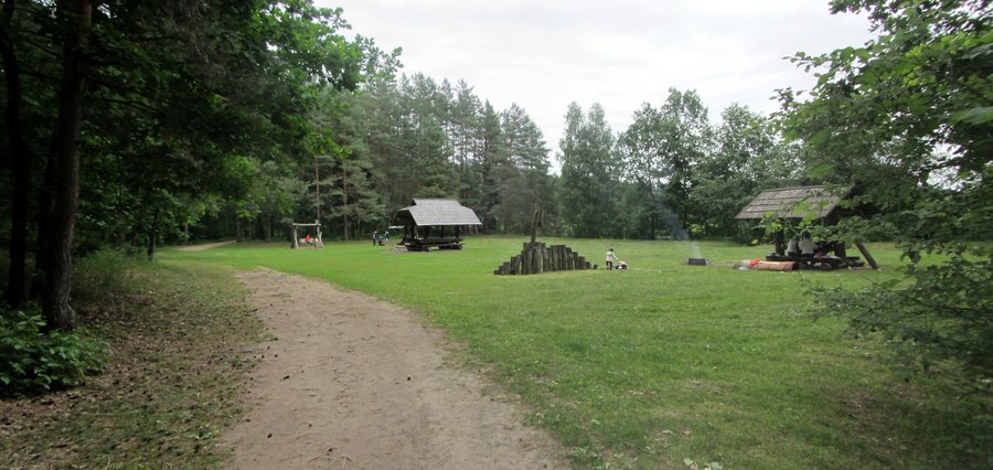
Kernavė combines archaeological history with trails through valleys and forests and along the Neris. The archaeological site includes the town of Kernavė and forms a complex of archaeological sites and historical and cultural monuments. Visitors seeking a cultural focus for their trip will find several different ways to explore it: museum exhibitions, an educational tour and trails through the site’s landscape.
 File:Kernavės sen., Lithuania - panoramio (48).jpg
Photo: VietovesLt via Wikimedia Commons, CC BY 3.0
File:Kernavės sen., Lithuania - panoramio (48).jpg
Photo: VietovesLt via Wikimedia Commons, CC BY 3.0
Museum and Archaeological Site
The Kernavė Archaeological Site Museum has three exhibition halls. They focus on the archaeological site, prehistory and the 13th- and 14th-century Middle Ages. The subjects therefore range from early periods to a specific period of the Middle Ages. During an educational tour, students can handle replicas as well as the finds kept in the museum. The replicas span the period from the Early Stone Age to the Late Middle Ages. For planning a culture-focused trip, this offers a distinct opportunity to learn about the finds and their place in history.
Exploring the Site on Foot
The approximately 4 km walking route through the archaeological site connects the lower and upper terraces of the Neris. It passes through archaeological areas, across the fields of the Pajauta Valley, through a ravine and through an ancient forest. The route also offers sweeping views of the Pajauta Valley. Visitors who would like to combine different landscape features and archaeological areas on a walk can include this route in their trip plans. Its approximately 4 km length provides a specific reference point for planning the day.
Another option is the Kunigaikščių takas (Prince’s Trail), an approximately 3 km circular route through the Kernavė archaeological site. It runs between the hill forts and down to the Neris. This circular route has a different focus from the longer walking route: its described course connects the hill forts with the river. You can choose between the two trails according to the route you prefer, while keeping in mind that their different lengths do not indicate how long either takes to walk.
By Bike and Nearby
An approximately 9 km scenic cycling route starts in the town of Kernavė. It passes through local pine forests and valleys and alongside river meanders. The route alternates between forest tracks and asphalt. Those who would rather focus on a cycling route than a walking trail can consider this option, with its varied surfaces and scenery.
The White Mountain Trail is another option nearby. This easy 2.6 km walking trail has rest areas and a viewing platform overlooking a bend in the Neris. It starts at the White Mountain Resort and can be reached by car from Kernavė via Pajautos Street. The stated distance and rest areas offer a useful guide for anyone looking for a shorter walk with a viewpoint.
The kind of trip you have in mind can also influence your choice of holiday rental: a plan that includes the museum and archaeological history may call for different priorities than one focused on walking or cycling routes. The trails mentioned here differ in length and course; the cycling route also runs partly on forest tracks and partly on asphalt. When deciding on Kernavė, you can consider which of these documented experiences best fits your travel plans.
More destinations: Vievis, Juodšiliai, Bezdonys, Eišiškės, Žydkaimis, Žuklijai, Lentvaris and Trakai.
Back to the broader travel overview: Vilnius District.

.jpg)