
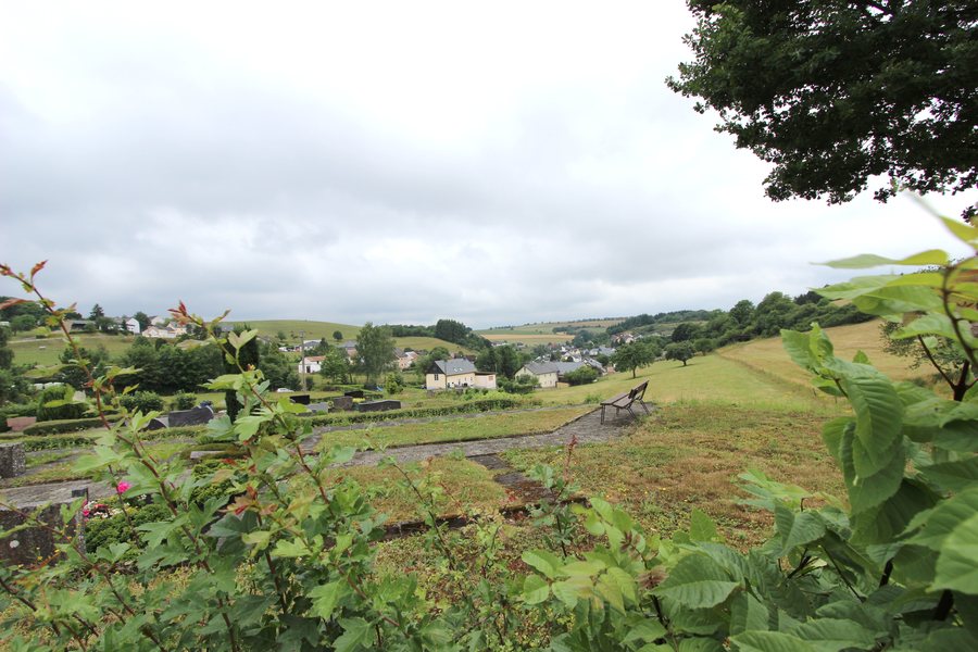
 File:Plütscheid (Eifel); Panoramablick Plütscheid c.jpg
Photo: Colling-architektur via Wikimedia Commons, CC BY-SA 3.0
File:Plütscheid (Eifel); Panoramablick Plütscheid c.jpg
Photo: Colling-architektur via Wikimedia Commons, CC BY-SA 3.0
Plütscheid can be explored via the hiking trails of the South Eifel Nature Park. The easy circular trail no. 19 starts in Plütscheid, is 7.6 kilometres long and takes around 2 hours 15 minutes. Along the route, there are views across the Eifel Heights and into the Prüm Valley. The tour combines proximity to the village with open landscape views.
A second easy circular route is South Eifel Nature Park hiking trail no. 20. It begins and ends in Plütscheid, measures 8.5 kilometres and takes around 2 hours 20 minutes. Near the destination, the route offers a panoramic view from a 530-metre-high summit. In direct comparison, trail no. 19 is the shorter tour, while trail no. 20 combines a longer route with a viewpoint at the end.
You can compare the different route lengths and approximate walking times when planning your day. The two circular trails can be distinguished by their duration without reducing their individual landscape impressions to a summary. The route data therefore provides a clear comparison between a shorter circular tour with views over heights and valley and a somewhat longer loop with a panoramic view near the destination.
The routes also have different focal points. While no. 19 focuses on the open views across the Eifel Heights and the Prüm Valley, no. 20 leads over a wooded ridge and connects this landscape section with the summit view. Route no. 21 adds woodland, proximity to water and historical traces to the network of trails.
Trail no. 20 follows a wooded ridge shaped over thousands of years by the Ehlenzbach and Kleiner Ehlenzbach streams. South Eifel Nature Park hiking trail no. 21 crosses the Geweberwald forest, with beech, oak and spruce trees. The trails pass heights, bodies of water and a forested area with different tree species.
Hiking trail no. 21 passes the abandoned village of Staudenhof. From Staudenhof, it follows narrow paths along the Prüm towards Mauelermühle before climbing again towards Plütscheid. At this remote location, the old school is considered the only house still suitable for habitation.
In the 19th century, Staudenhof was considered Germany’s smallest municipality. Around 1821, the settlement covered 18 hectares and had around 128 inhabitants.
Plütscheid is considered a place without a direct rail connection; Bitburg-Erdorf is considered the nearest railway station. A car park for the hiking trails is located in the centre of Plütscheid near Hauptstraße 2, between Gasthaus Geimer and the parish church.
When selecting a holiday apartment in Plütscheid, travel dates, room category and cancellation conditions can be considered alongside the different route lengths, walking times, landscape sections and historical stops in your personal planning.
Herzfeld, Mauel, Preischeid, Lierfeld, Lünebach, Eilscheid, Strickscheid, Harspelt
For the overarching travel overview: Arzfeld.
Check prices, availability and amenities for your travel dates directly on Booking.com.
View accommodations and offersAdvertisement · Partner link to Booking.com
;_Panoramablick_Pl%C3%BCtscheid_c.jpg)