
Hittbergen: Elbe Floodplain, Cycling Route and Architectural History
Accommodation in Hittbergen
Hittbergen and Barförde lie in the Elbe floodplain, at the start of the Lower Saxon Elbe Valley Biosphere Reserve. Two themes are particularly prominent when exploring the area: the Elbe Cycle Route and an architectural history that ranges from a decommissioned windmill to St. Martin's Church. If you are looking for a holiday apartment, these highlights can help you decide whether Hittbergen matches your interests in the landscape, cycling and architecture.
Cycling Route and Architectural History in Hittbergen
The districts of Hittbergen and Barförde lie along the Elbe Cycle Route. In the region, this long-distance cycling route is considered probably the most popular of its kind. Cycling is therefore a natural point of reference when planning your trip. Check current route conditions before setting off.
A notable building is the old gallery-style Dutch windmill in Hittbergen. It has been out of service since 1961, now serves as a residence and can only be viewed from a distance. Its history is therefore best appreciated from the outside: the mill is not an accessible visitor attraction, but a building whose former use and current status help shape the character of the area.
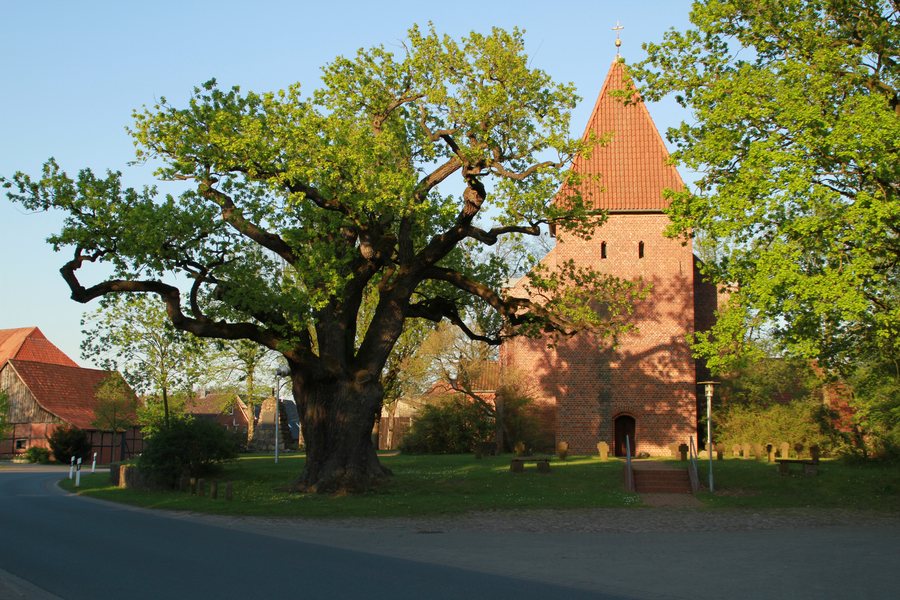
St. Martin's Church offers a different perspective on local architecture. The Neo-Gothic church was built onto a fortified medieval tower between 1872 and 1875. Inside, an elaborate beam ceiling extends beneath the entire vault. The pulpit is also flanked by five surviving side figures from a former winged altar depicting Mary. The tower, the later church building and the preserved altar figures each highlight a different period in history. Thus, the windmill is chiefly viewed from a distance and noted for its present-day residential use, while the church stands out for its architectural development and furnishings.
Other Landscape and Cultural Highlights in the Lüneburg Travel Region
In the wider Lüneburg travel region, the erratic boulder circle near Breetze, in the Bleckede district, displays boulders that bear witness to the glacial formation of the Elbe glacial valley. The boulder circle is freely accessible and parking is available; check the latest information before your visit. Another glimpse into the past awaits at the megalithic tombs in Schieringer Forst, between Barskamp and Walmsburg. They were built during the Neolithic period, between 3000 and 2300 BC. A circular hiking trail leads from Walmsburg village square to the tombs. Geological features and Stone Age structures thus offer two different ways to explore the landscape history of this wider travel region.
Technology and nature are also represented there. The Lüneburg Ship Lift in Scharnebeck is the largest ship lift of its kind in Germany. The Biosphaerium Elbtalaue in Bleckede combines an aquarium landscape, live beavers and more than 1,000 m² of modern exhibition space. At the Scharnebeck climbing forest, routes between platforms range from three to four metres in height up to 15 metres; the zip-line course is 435 metres long. As operator information may change, check the latest details before visiting. These examples each offer a different focus: an engineering facility, insights into the Elbe floodplain and climbing between platforms.
The wider Lüneburg travel region also offers walks and hikes of varying lengths. The circular route around Lopausee and through Lopaupark in Amelinghausen is 2.2 km long and intended for jogging, walking and Nordic walking. The Queen's Trail is an 11-kilometre circular hiking route around the heath village of Amelinghausen. Comparing the distances highlights the different lengths of the routes without suggesting they are alike. The Amelinghausen collective municipality also holds its Heath Blossom Festival every August, featuring the crowning of the Heath Queen and a large parade. Dates and programmes may vary, so check the latest information when planning your visit.
City and town hall tours in Lüneburg showcase gabled brick houses, old lanes and the waterfront district. For another view over the city and its surroundings, head to the Lüneburg Water Tower, whose viewing platform is 56 m above ground. It hosts classical concerts at 8 pm on the first Sunday of every month and at every full moon. Check the dates as you plan your visit. Together, these examples in the wider Lüneburg travel region offer a broad range of experiences, from urban history and panoramic views to festival traditions, hiking trails and nature.
When choosing a holiday apartment, you can decide whether to focus on Hittbergen's Elbe floodplain, cycling route and local architectural history, or also include other destinations in the wider Lüneburg travel region. The regional attractions mentioned are located in the places described; they complement the picture of Hittbergen without replacing the area's distinctive features.
Discover More Destinations
Discover more destinations: Barum, Westergellersen, Nahrendorf, Lüdersburg, Vögelsen, Artlenburg, Neu Garge, Deutsch Evern
To the overview of the wider travel region: Lüneburg.

