
Discover Calw
Accommodation in Calw
Hiking routes in the Central/North Black Forest Nature Park, a castle with preserved foundations dating from the 12th century, and unusual excursion ideas shape the experiences around Calw. There is also a nature trail, a local history museum and regional food experiences. This lets you tailor your stay to the interests that matter most to you: nature and activity, history or special discoveries for the whole family.
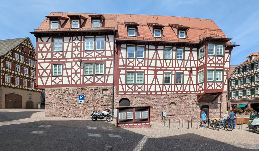 Calw-314-Salzgasse-Nr4-Marktplatz-Nr7-2026-gje.jpg
Photo: Gerd Eichmann via Wikimedia Commons, CC BY 4.0
Calw-314-Salzgasse-Nr4-Marktplatz-Nr7-2026-gje.jpg
Photo: Gerd Eichmann via Wikimedia Commons, CC BY 4.0
Enjoy hiking and the landscape
In and around Calw, there is a wealth of well-marked paths and routes where you can explore the Central/North Black Forest Nature Park on foot. If you enjoy walking, you can make hiking a central focus of your trip. The routes lead through the nature park; specific trail lengths or stages are not specified here. So when planning your holiday, the first question is how much time you want to devote to hiking and what other experiences you would like to include in your stay.
Castle ruins and rural cultural history
The ruins of Hohennagold Castle are located on Nagold Castle Hill. The foundations of various buildings dating from the 12th century are still preserved in the castle’s inner section. These visible remains give the castle complex a tangible historical connection: rather than simply learning a date, you can see the preserved foundations as part of the former buildings. Those interested in regional history will also find a dedicated focus at the local history museum in the former Fruchtkasten granary in Wildberg. It covers the history of Reuthin Dominican Convent, textile production at the time and the cultural history of rural clothing. The subjects thus range from the medieval castle’s inner section to monastic history and everyday culture.
Discover with children or enjoy an active outing
The Haiterbach Nature Trail introduces visitors to trees and their leaves, as well as the geology of the quarry, in a child-friendly way. At the animal long-jump activity, visitors can compare how far different animals can jump. This experience combines nature education with a hands-on activity and may appeal to families who want to do more than simply spend time outdoors—they can discover something together, too. Another kind of excursion is offered by the handmade, single-seat hot rods, which are used for trips through the Black Forest from the grounds of the Old Blanket Factory in Calw. They reach speeds of up to 90 km/h. Nature observations and a ride in a motorized vehicle appeal to different interests; when choosing your excursions, you can therefore focus on the kind of activity you prefer. The Schömberg Barefoot Park adds another option, with a route about 800 metres long that includes more than 20 different materials. Its approximate length and variety of materials clearly define the experience and distinguish it from the historical and motorized attractions.
Coffee and the bakehouse festival
At the coffee roastery in Calw, visitors can discover coffee with all their senses and learn the secrets of the coffee bean. It is a great suggestion for anyone interested in the taste and origins of a familiar product, as well as hiking and excursions. Another culinary tradition is the bakehouse festival in Ebhausen. It takes place every year on the first weekend in May. As part of the programme, visitors can sample onion tart and wood-fired bread from the local bakehouses. If you want to plan your trip around this event, the first weekend in May is the specific time to bear in mind.
Tailor your stay to your interests
When choosing a holiday apartment in Calw and the surrounding area, it helps to first consider which experiences matter most to you. Hiking in the nature park, a cultural-history discovery, a nature trail or the bakehouse festival each offer a different focus for your stay. You can also choose a specific location based on which of these experiences you would like to plan for. The information about each attraction describes different places and subjects; they do not form a single route. This way, your search for a suitable holiday apartment can reflect your own travel preferences without committing you to just one kind of holiday. For a stay with children, the Haiterbach trail offers an explicitly child-friendly introduction to trees, leaves and geology. Those interested in history can explore the Hohennagold ruins or the local history museum, while nature and food experiences provide further inspiration for planning your own excursions.
More local pages to help with your search: Oberreichenbach, Wildberg, Simmersfeld, Neubulach, Nagold, Schömberg, Bad Teinach-Zavelstein, Ebhausen, Gechingen, Althengstett, Bad Herrenalb, Ostelsheim, Rohrdorf, Simmozheim, Egenhausen, Dobel, Höfen an der Enz, Haiterbach, Neuweiler, Altensteig, Enzklösterle, Bad Wildbad, Unterreichenbach, Calw and Bad Liebenzell.
See the broader travel overview: Baden-Württemberg.

