
Lapalice – Cycling routes between forests and lakes
Accommodation in Lapalice
Lapalice can be explored via several cycling routes, each with very different details: one runs along Jezioro Rekowskie to Zamek w Łapalicach, while others pass through several villages or through forests and fields. The Zamkowa Trasa Rowerowa is 5.2 kilometres long; a section between Kartuzy and “Złota Góra” covers 13.2 kilometres, and the Północna trasa gminy Kartuzy is a 32.8-kilometre circular route that ends in Lapalice. These different route profiles give families specific points of reference for planning their cycling activities during their stay.
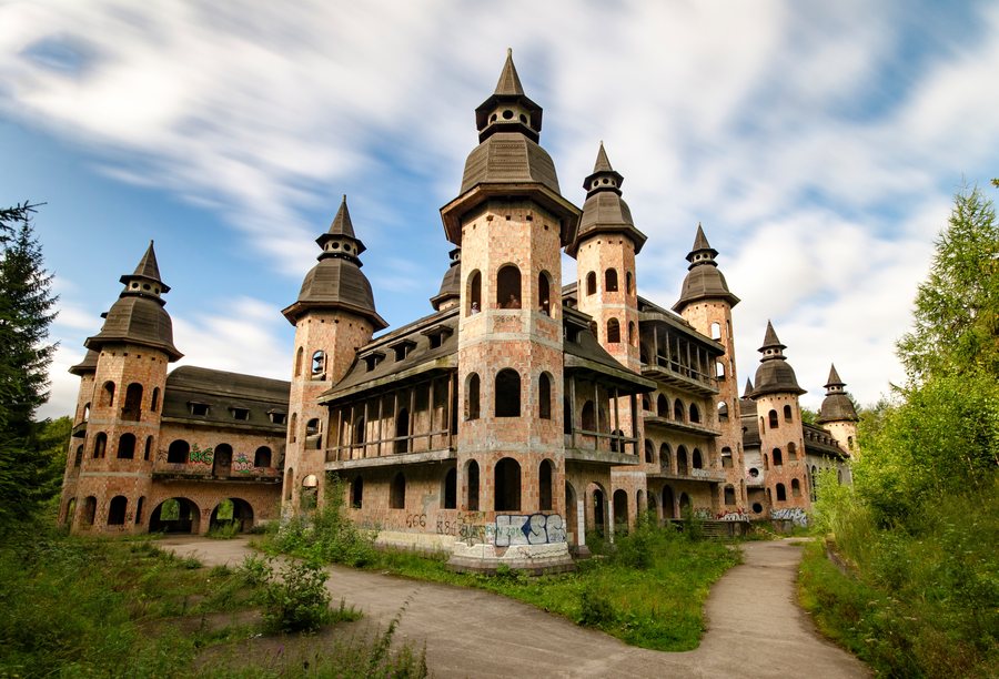
From the lake to Zamek w Łapalicach
Trasa nr 1 (Łapalice) runs along Jezioro Rekowskie and reaches Zamek w Łapalicach via a narrow forest path. The lakeshore and forest path thus shape the description of this route before it leads to the contemporary building. The narrow path is a specific feature you can take into account when planning your day. The Kartuzy–“Złota Góra” cycling route also passes Zamek w Łapalicach; the contemporary building is among the attractions mentioned along the route. This means the castle’s name appears in two different route descriptions, without suggesting that they should be treated as one combined route.
Signposted route and path through several villages
The Zamkowa Trasa Rowerowa runs from Łapalice to the municipal boundary between Kartuzy and Chmielno, near Rekowo. It is 5.2 kilometres long, and the route is signposted on the ground. This provides both the route’s course to the municipal boundary and a specific distance to help with navigation. The Kartuzy–“Złota Góra” cycling section is longer, at 13.2 kilometres, and passes through Łapalice, Garcz, Chmielno, Zawory and Ręboszewo. The village names give this section a different character: instead of a route ending at a municipal boundary, the focus here is on the several villages it passes through. When comparing different route formats, you can include these details in your holiday plans as separate options.
Forests, fields and several lakes
The Północna trasa gminy Kartuzy is a 32.8-kilometre circular route that ends in Lapalice. It runs mainly through forests and agricultural fields and passes several larger lakes. These include Rekowo, Łapalickie, Białe and Sianowskie. This tour’s description differs from those of routes that focus primarily on a single destination or several village names: here, the forest and field landscape and the several lakes shape the route. When choosing a cycling itinerary, you can therefore consider whether you would prefer to plan a route with a named destination, a section through several villages, or a circular route featuring these landscape characteristics.
Cycling plans and accommodation choices
The route descriptions place different emphasis on the course of the route and the landscape.
More places in the same directory: Rąb, Brodnica Dolna, Zukowo, Brodnica Górna, Mezowo, Sianowo, Stare Czaple and Garcz.
Back to the main travel overview: Karthaus.

